Aconcagua recap

After about two weeks in the Andean mountains we are back in Mendoza, Argentina, where we started our expedition to Aconcagua, the highest peak in South America.

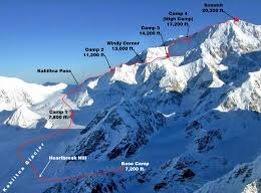
We started our trip with a three days’ hike up to the Plaza Argentina base camp at 4200 meters. This was the easiest part for us because mules carried most of our baggage. We even had one river crossing on the back of mules which was fun. Above base camp, there were three more camps before we could try to reach the summit. At camp 2 (5400 m) we were stuck for four nights because of a storm that brought quite a bit of snow, before we could move on to camp 3 at 5900 m.

At 5 AM Monday morning we left the camp and started the ascent to the summit, wearing our headlamps in a cold night. The way to the summit was pretty long and tough. The snow was knee-deep, and although our guide Chhering did a fabulous job breaking the trail for us, I was very exhausted the further up we came. At 2 PM we finally reached the summit and were rewarded with a stunning 360 degrees view and hardly any clouds.

The way back down to our camp took us three and a half hours. The next day we descended to base camp Plaza de Mulas on the other side of the mountain and were lucky to get a helicopter flight out to the trailhead instead of hiking out the next day.

Now we are enjoying the Argentinian summer and cuisine in Mendoza. I stay here until tomorrow, then I’ll spend a couple of days in Buenos Aires before I return to Norway on Saturday.

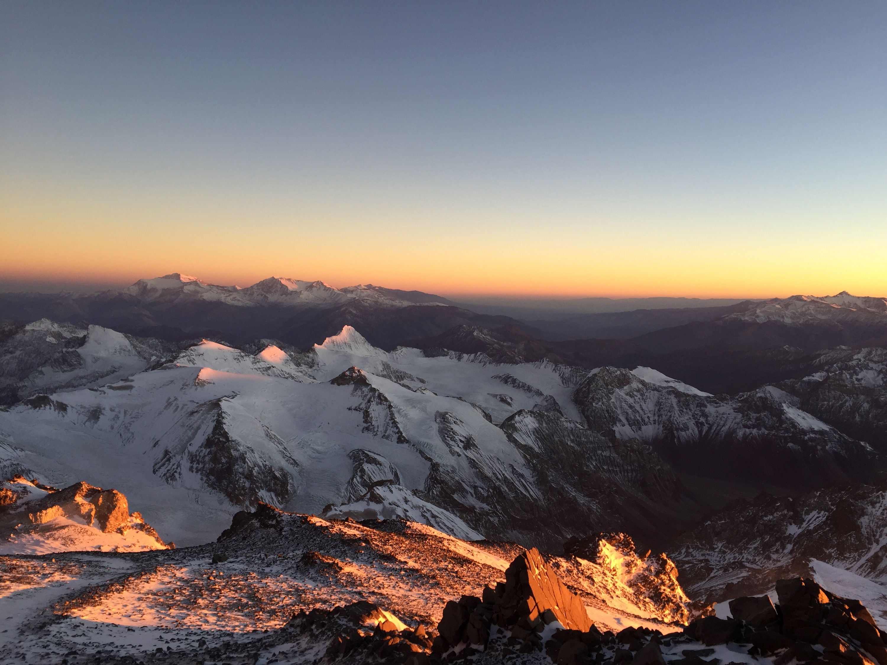
Mountain panorama on summit day right after sunrise
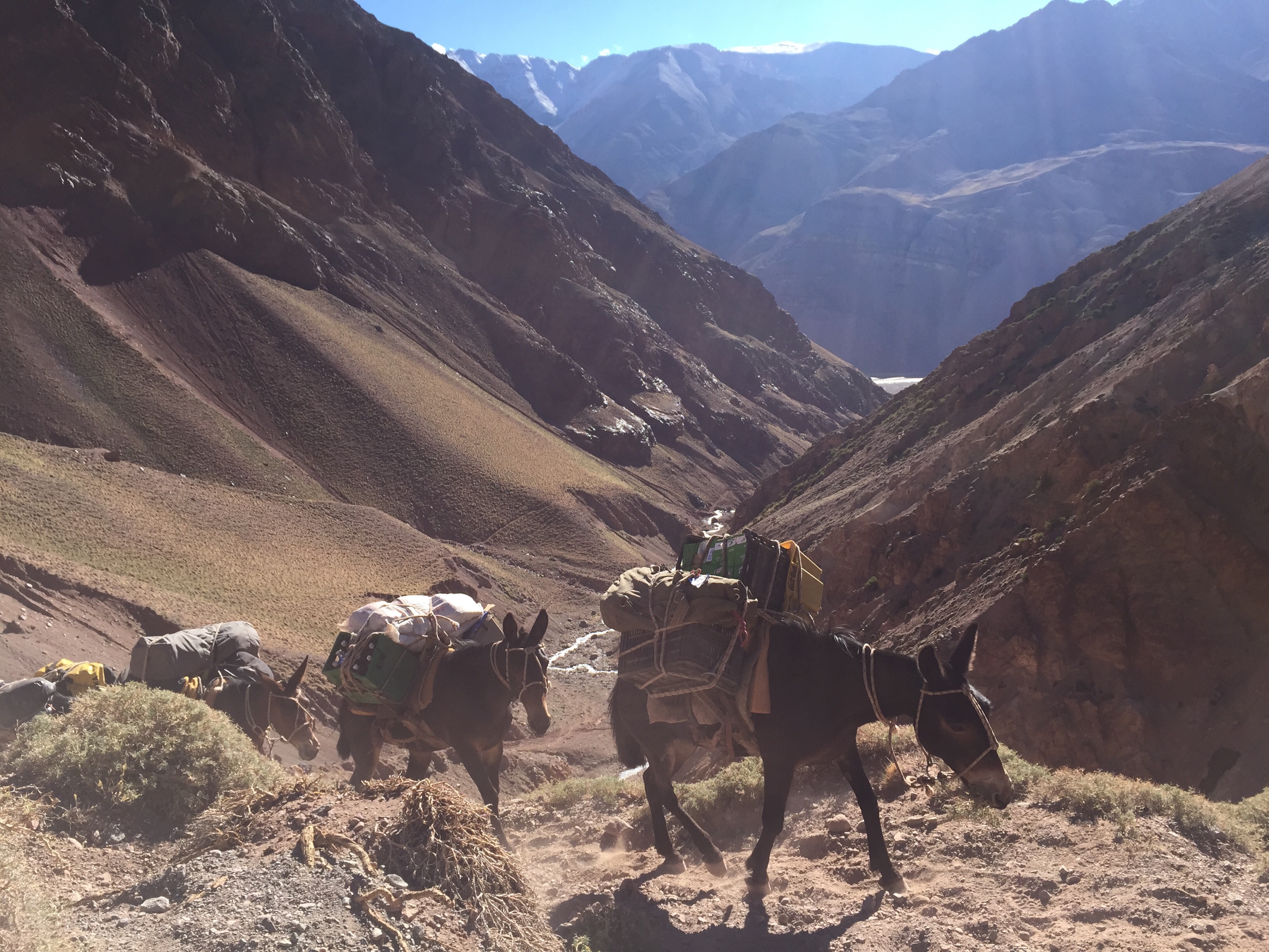
Mules – our trusted partners on the way to base camp

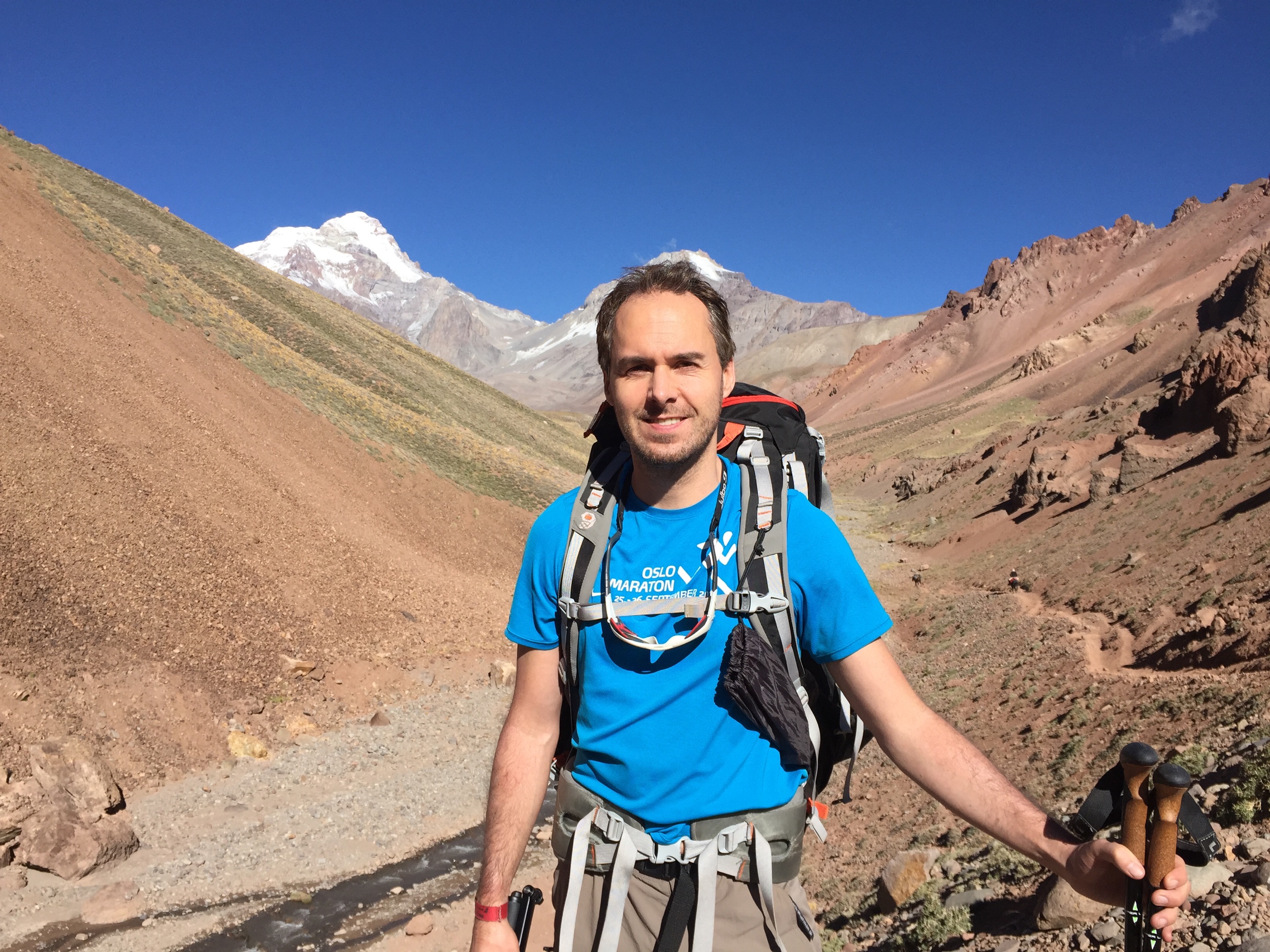
Day 3 on the way to base camp – Aconcagua in the background

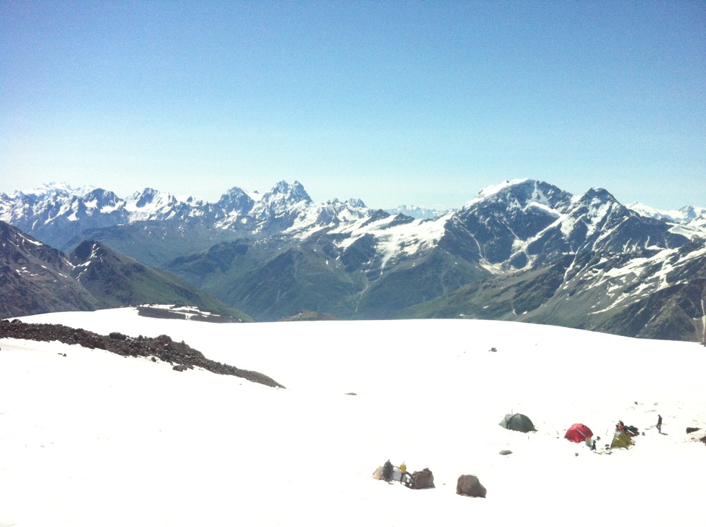
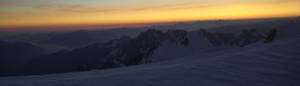
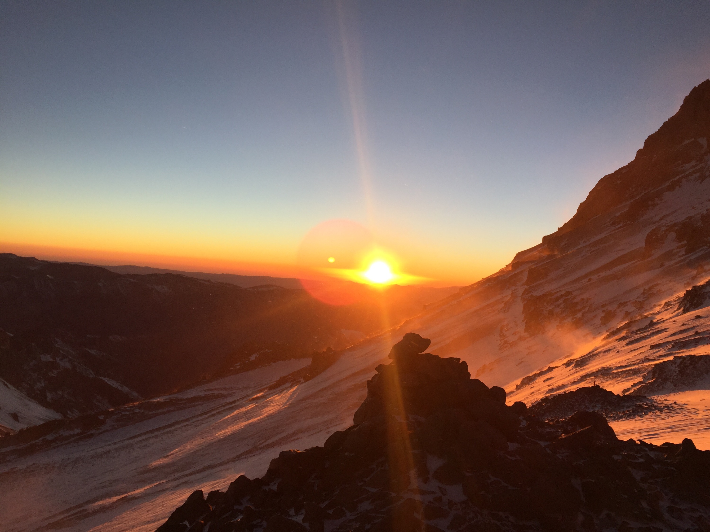
Sunrise on summit dayView from camp 2 after the storm

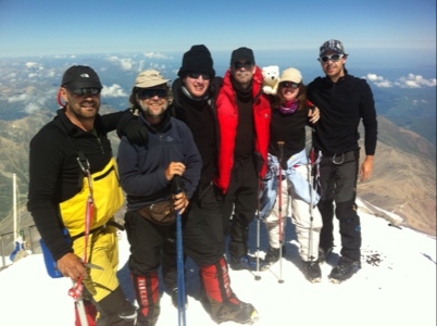
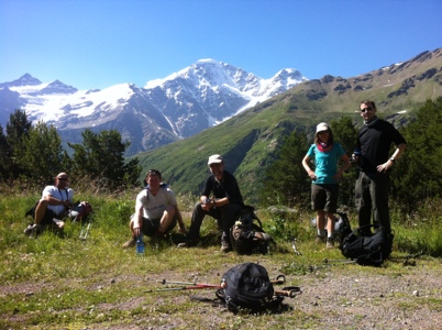
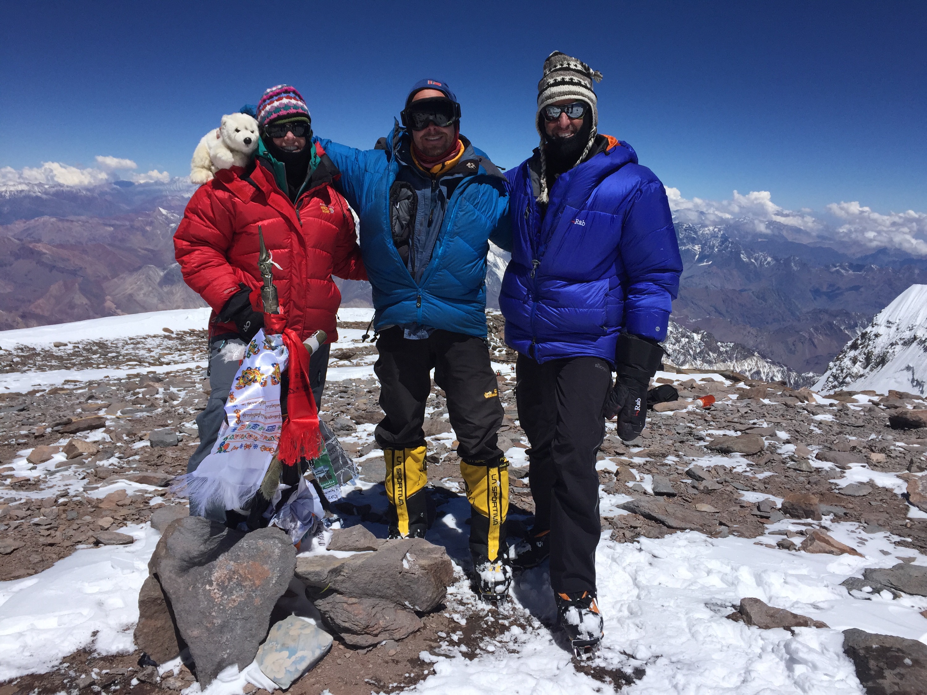
Summited (from left to right): Mr. Nansen, Jodi, Stephan and Richard

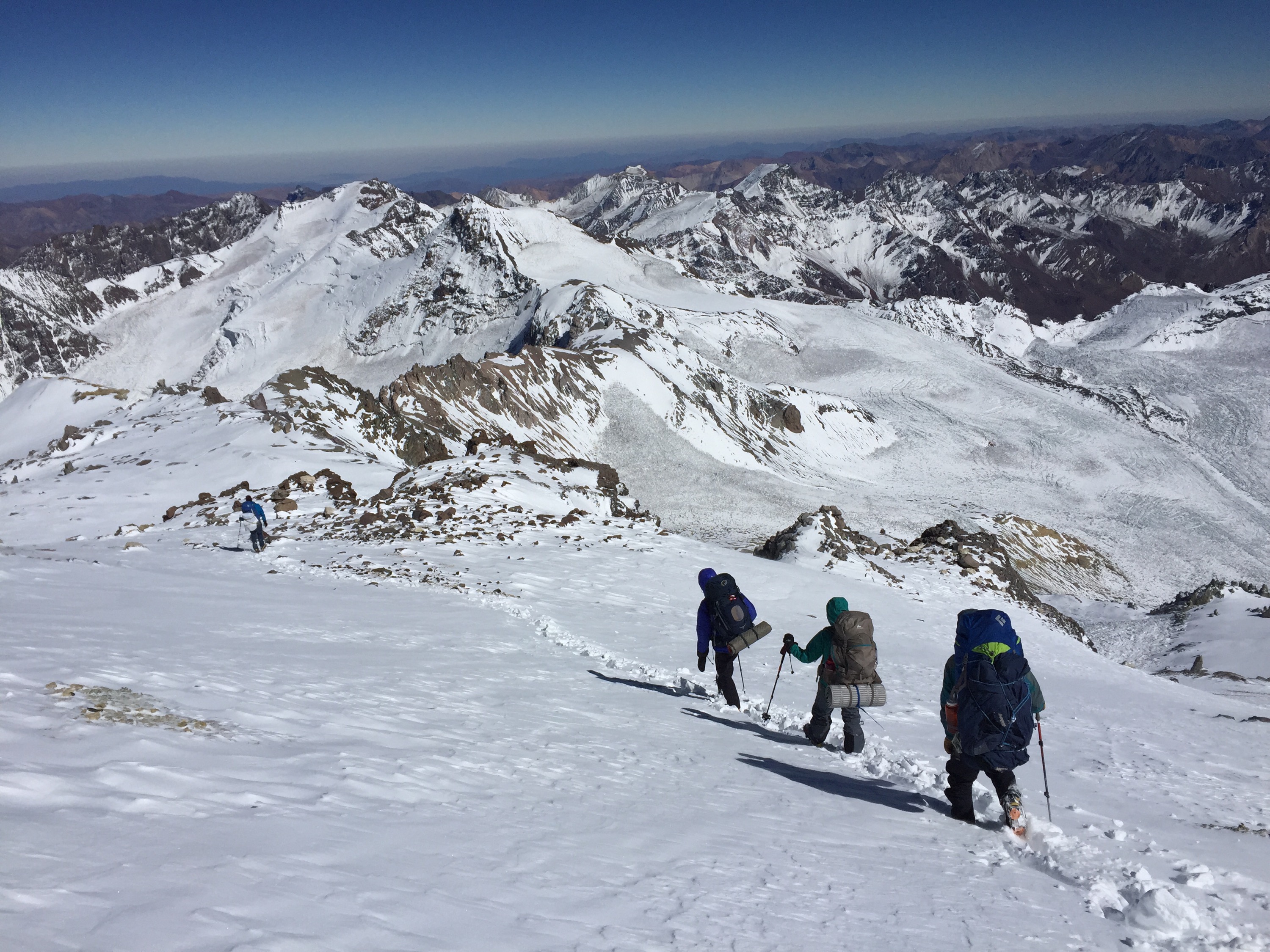
Descent from high camp to base camp

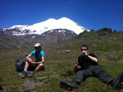
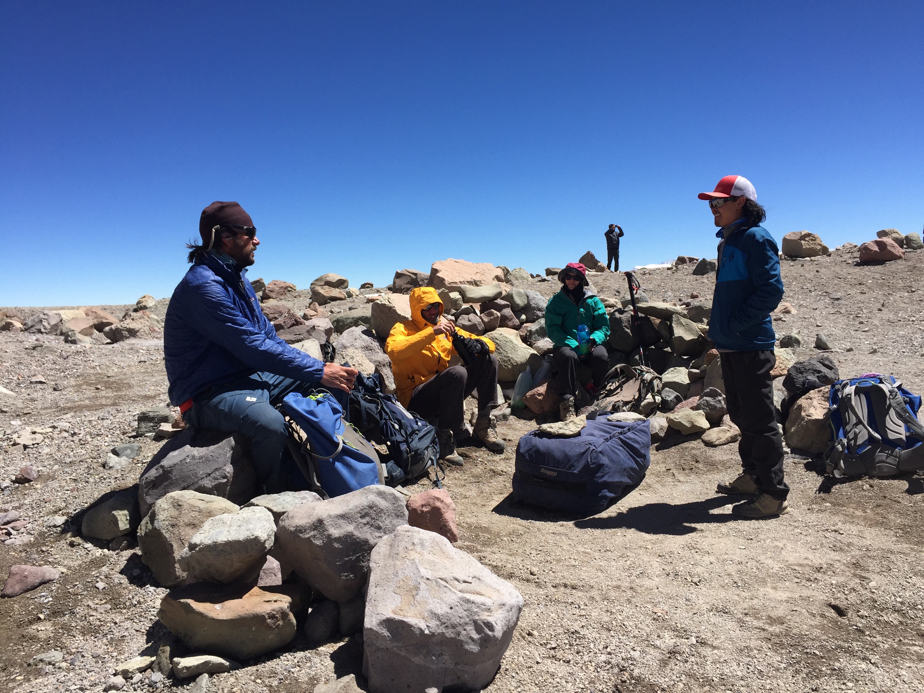
Short break with guides Ryan (left) and Chhering (right)

¡Vamos a Argentina, señor Nansen!

Here we go again! The only mountaineering polar bear Mr. Nansen and I are heading off to our next adventure. This time we’re going to South America, more precisely to Argentina where we are going to make an attempt to climb Aconcagua. Aconcagua (6961 m) is the highest mountain in South America, the highest mountain in the Western and Southern Hemisphere, and the highest mountain outside the Himalaya. We’ll first go to Mendoza where we’ll meet our guide Ryan Waters and the rest of the team, and then we’ll start our expedition on Monday. Hopefully after about two and a half weeks, we will be back in Mendoza and celebrate with Argentinian steaks and red wine. I’ll keep you posted. In the meantime, check also www.mtnprofessionals.com/news for blog updates from the mountain.

(null)

This year’s summer holiday goes to: Mallorca! Just kidding…

Here is a short pre-expedition post from Reykjavik. I have packed my wool underwear, down jacket and down pants, and I’m ready for this year’s adventure: We are going to climb Denali (aka Mount McKinley), North America’s highest mountain at 6168 meters. We, that is a team of two Norwegians, one American, one Englishman and myself plus Mr. Nansen together with three American guides. I know two people on this team from before: Marius who was a part of the Greenland team last year and our guide Ryan with whom I climbed Kilimanjaro two years ago.

My plan for the next days is arriving in Anchorage late local time tonight, staying there for one night, watching Germany win against Ghana tomorrow and then taking a shuttle bus to a small place called Talkeetna. There we will have a mountain skills workshop on Sunday and start our expedition on Monday.

The expedition follows the West Buttress route which is the most common route on Denali. We are going to fly in to Kahiltna base camp with a small airplane which can land directly on the glacier. The base camp is at 2200 m altitude, and we’ll have a total of three weeks for our expedition which will hopefully take us all the way to the summit and back.

That means three weeks of winter camping which I am looking forward to a lot, although Denali is notorious for its bad weather (which means mostly storms and extremely low temperatures). Then again, I am quite confident that the weather can’t be much worse than on our trip across Greenland last year. Otherwise we follow Anne’s word of wisdom: “Either it goes well, or it goes over.”

Note on the name of the mountain: It got its McKinley name as political support for Republican presidential candidate William McKinley from Ohio in 1896. Today in Alaska and among mountaineers it is more common to use the traditional Athabaskan (Native American) name Denali which translates into “the High One.”

I may drop another note here before we leave on Sunday or Monday. After that you can follow our expedition on Ryan’s website http://www.ryanwaters.net/dispatches.html (see the dispatches section).

20140620-161920-58760994.jpg

Departure day

After two intense days of preparation, we are almost ready to leave Kangerlussuaq and start our 26 days’ trip towards Isortoq at the east coast. 26 breakfasts, 26 lunches and 26 dinners are packed in day portions now. My personal equipment is packed on sled no. 1. The shared equipment will be packed on sled no. 2.

In a few hours we will enjoy a musk ox burger at the airport, and that will be our last meal which is not dry frozen. After that our restaurant is called Real Turmat.

Tonight we will first be transported by bus to the glacier and then go for an hour or so where we will establish our first camp. Tomorrow will be our first long day with 12 times 30 minutes.

When we leave civilisation tonight we won’t be able to use our cell phones anymore. So my next update will hopefully be from the east coast on May 27th.

20130501-123313.jpg

Greenland, here we come! One week until departure

Almost exactly 125 years ago, in August 1888, Fridtjof Nansen and his men left on their pioneer expedition trying to become the first ones to cross the Greenlandic inland ice. Their motto was literally “West coast or death” because they knew that nobody would come and rescue them if they didn’t reach the West coast. They started from Umivik on the East Coast and reached the Ameralik fjord on the West Coast 40 days later.

Now it’s only one week left until we leave the Norwegian spring to start our four weeks’ adventure across the Greenlandic inland ice. Us, that is a group of fourteen people: Eleven of which are born with skis on their feet (read: Norwegians), plus one Dane, one Swiss and one German. Three guides and eleven rookies. Six ladies and eight gentlemen. And one polar bear of course – my fluffy friend Mr Nansen is joining the trip as well.

Since our first training meeting in September, we have been preparing for the expedition. The most essential part of the training was pulling old car tires in the Norwegian woods – the closest you get to pulling a sled. Fortunately, we had a long and cold winter in Oslo with plenty of opportunities to go skiing as well.

Another part of the preparation for myself was eating as much and as rich in calories as possible. That includes chocolate, potato chips, popcorn (with lots of butter), some extra butter/oil/cream in every meal, Coke and Solo and so on. The idea is that some extra fat (or should I call it blubber?) both protects you from the Arctic cold and provides an energy reserve on exhausting days which is important since it is almost impossible on the trip to feed the body as many calories as you burn during the day.

Every one of us will have to pull two sleds over Greenland, and we will have everything we need on the expedition with us (food, fuel, and personal equipment). In adventurer terminology you call this kind of expedition “unassisted” (no external supplies or depots) and “unsupported” (using only muscle power – no kites etc.).

Our route goes from West to East. On Tuesday next week we will board a plane from Copenhagen to Kangerlussuaq, and on Wednesday we will start our trip from Kangerlussuaq. We will be driven to the edge of the glacier from where we will start to ascend the ice cap. The first few days have the most difficult terrain. After a while the landscape flattens out but we will still gain altitude every day until we reach the highest point at approximately 2500 meters. From there we continue towards the East coast, and after 26 days and approximately 600 kilometers on skis we will hopefully reach the small settlement of Isortoq.

This time I have no chance to update my own blog. We only have one satellite phone, but you can follow us on facebook under “Grønland 2013”.

http://www.facebook.com/#!/Gronland2013?fref=ts

Different routes over the inland ice – ours is the blue one from Kangerlussuaq to Isortoq

Elbrus day 8-9: Hot summit day

We got up at 1.30 AM and had a little snack for breakfast before we started our summit attempt at 3 AM. The weather was perfect: a starlit sky, temperatures just below zero and practically no wind.

We started at the bottom of Pasthukov Rocks at 4550 meters and had to begin on a rather steep slope. The snow was very firm though and easy to walk on.

Right before we reached the saddle between the West and East peak at 5300 meters we came into the sun and we soon had to take off several layers of clothes. The ascent from the saddle to the West plateau at 5600 meters was the toughest part. From there it was only an easy, almost flat walk, and at 11 AM we were standing at the top of Elbrus at 5642 meters and could enjoy the view for quite a while since it was warm and no wind at all.

The descent back to our camp at 4100 meters was quite a challenge because it was hot, very intensive sunlight, and we were running out of water. At 2 PM we were very happy to be back in our camp and could enjoy some cold water and juice.

After one more night up on the mountain, we are now back at our hotel in Terskol and enjoy the privileges of civilisation like a decent toilet and a warm shower. Today we will go for an easy hike in Terskol valley. Tomorrow we will fly back to Moscow before I return to Oslo on Wednesday.

20120723-094847.jpg
– Tommy, Sasha, Derry, John, Mr. Nansen, Róisín and myself

Elbrus day 7: Preparing for summit night

After one night at 3000 meters and two nights at 3850 we have just moved up to our last camp at 4100 meters. We are staying in containers which are not luxurious, but OK. The toilets are not five star either which is annoying because I caught some virus or bacteria and have been going there every couple of hours since yesterday morning.

The weather yesterday was a bit cloudy and windy. Today it is fantastic again – warm and sunny. There was a group though who tried to summit last night, and they had to turn around because of strong winds at the saddle. We are going to try the summit tonight starting at 3 AM, so until then we just have to prepare our equipment and relax.

Elbrus day 3: Another hot day in the Baksan valley

Today was another sunny and very warm day in Terskol. We walked up to Mt. Terskol today to an observatory at 3050 meters. From there we had a fantastic view on Mt. Elbrus with its two peaks.

20120716-192119.jpg
Mount Elbrus: We are going to climb the West Peak on the left, slightly higher than the East Peak

Now we’re back at the hotel relaxing after another sauna visit, soon ready for dinner. Tomorrow we will leave Terskol and start our ascent on Elbrus. As a first step we will move up to the mid station of the ski lift at 3000 meters where we will spend one night.

Everybody is in good shape and the weather forecast looks promising for the whole week and especially for our summit day on Saturday with a clear sky, light wind and temperatures only down to minus nine degrees centigrade.

20120716-192425.jpg
Our group (from the left): Tommy, Derry, guide Sasha, Róisín and John

Elbrus day 1-2: Slow warm-up in Terskol

We arrived yesterday after a rather wild car ride from the airport at our hotel in Terskol in the Russian republic republic Kabardino-Balkario. I’m sharing a room with Tommy from Norway – the most experienced guy in our group who has climbed Mt. Everest and five of the Seven Summits. The rest of the group is completely Irish: two guys, Derry and John, and a girl, Róisín. And our Russian guide Sasha of course who always has a good joke to tell.

Today we went for a small acclimatisation tour from our hotel at 2000 meters up the Cheget mountain just to the top of the ski lift at 3000 meters. This was a half day’s tour only so we could enjoy a nice lunch and go to the sauna later.

Learning of the day: the lady in the café was surprised that I blended beer with Sprite. Sasha explained me why: “Stephan, see: In Russia we don’t mix beer with lemonade. We mix beer with vodka. Actually, we say when you drink beer without vodka, it’s like throwing money to the wind.”

20120715-215354.jpg
View from our hotel

Seven Summit #2: Elbrus (5642 m)

After one week back in Oslo, I’m now ready for my second Seven Summit: Mt. Elbrus in Russia, the highest mountain in Europe at 5642 meters.

Mr. Nansen and I will take a flight to Moscow tomorrow morning and continue by plane to Mineralnye Vody in the North Caucasus region, close to the border to Georgia, on Saturday. From July 15th to 20th we will slowly move up on the mountain, starting at 2000 m in the town Terskol, and with our highest camp Priyut/Diesel hut at 4160 m, and we will have time for several acclimatization tours. From Priyut it is 1500 meters altitude difference up on our summit day, which is more than we had on both Kilimanjaro (1300 m) and Mont Blanc (1000 m), so this is going to be a tough day. Our schedule has three opportunities for the summit (in case we are stopped by bad weather), so we should reach the top between July 21st and 23rd.

Since the prices for data roaming in Russia are sky-high and I assume that we won’t have a WLAN available, we’ll have to try a back-up solution to update the website (MMS to Klaus, Klaus posting to blog). Anyway, the updates might not be as frequent as on the Mont Blanc trip.