Aguas Calientes and Machu Picchu

The fourth day of our Salkantay trekking started with two hours of zip lining over a canyon. It is hard to describe how much fun this activity was, so it’s best to watch the video on my Instagram account.

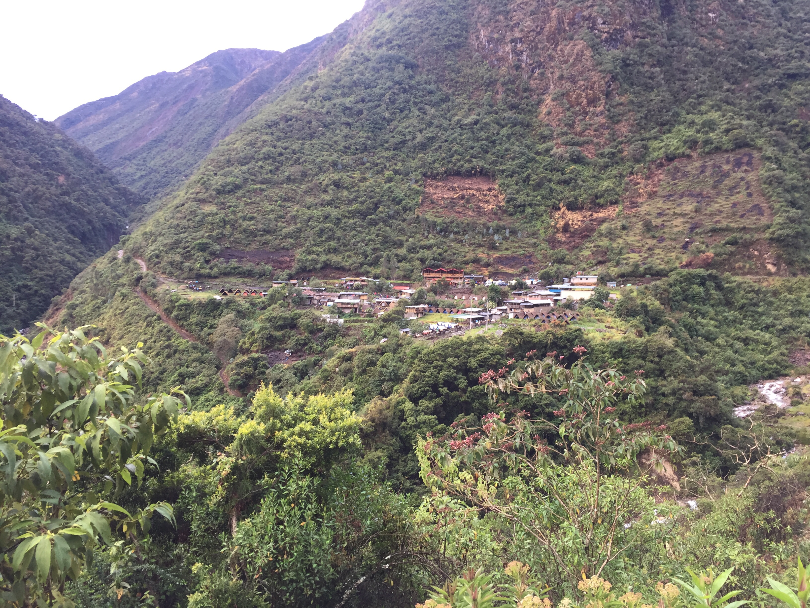
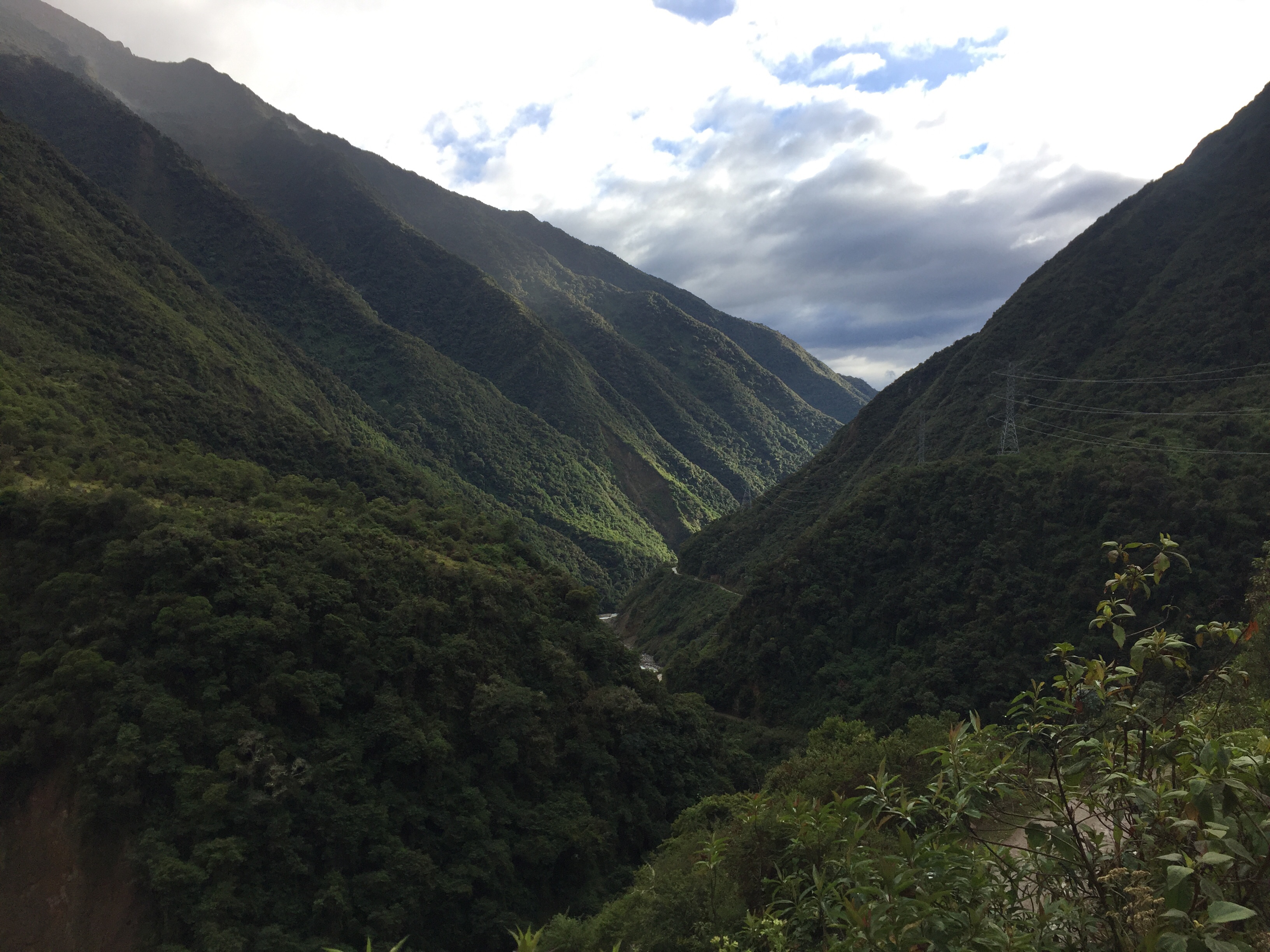
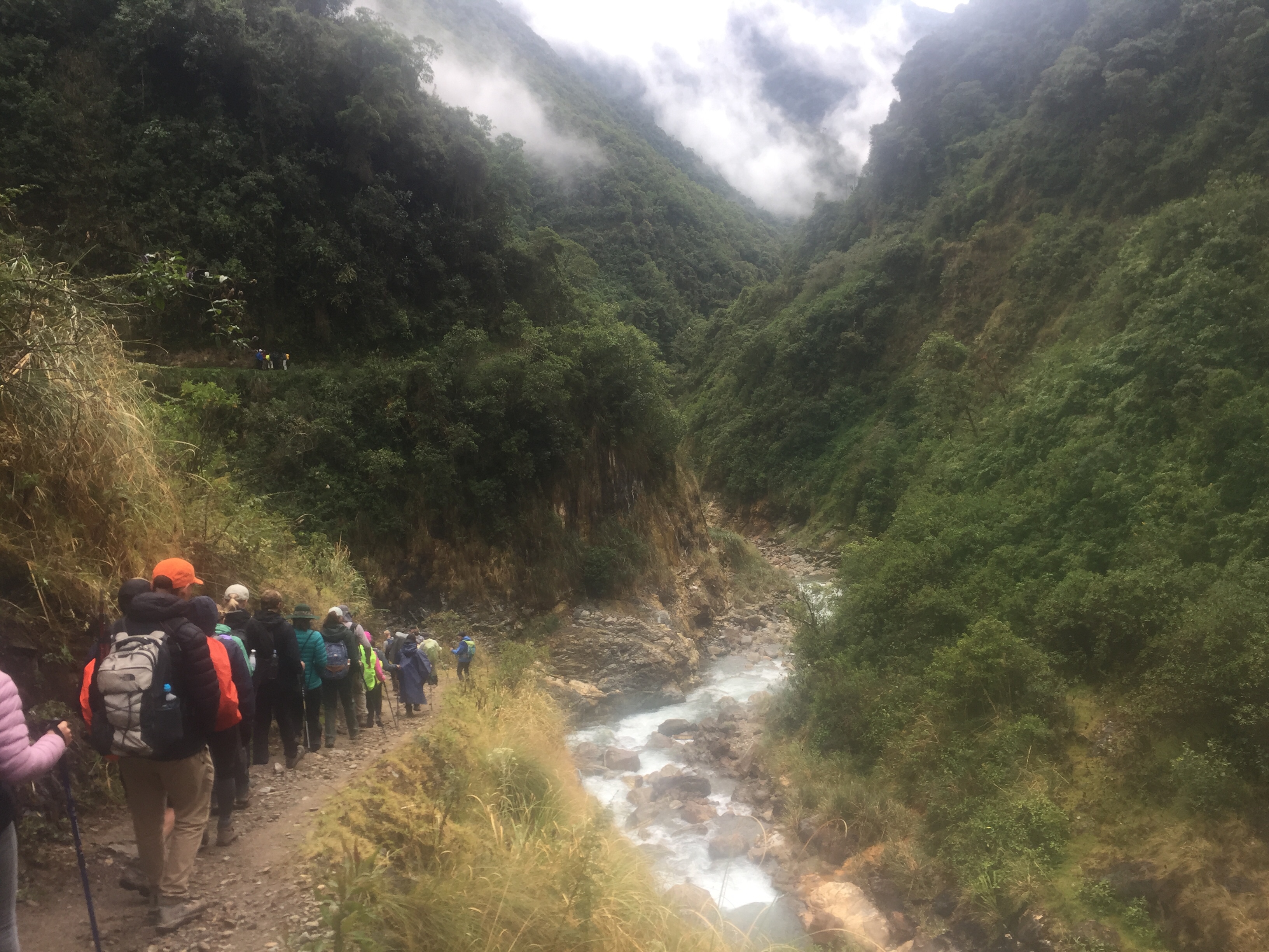
After the zip lining, we continued our hike along the rail tracks from Hidroelectrica to Aguas Calientes – a small town at the foot of Machu Picchu. It was sunny and very warm, and the hike through the jungle was beautiful, including some groups of parrots flying over our heads.

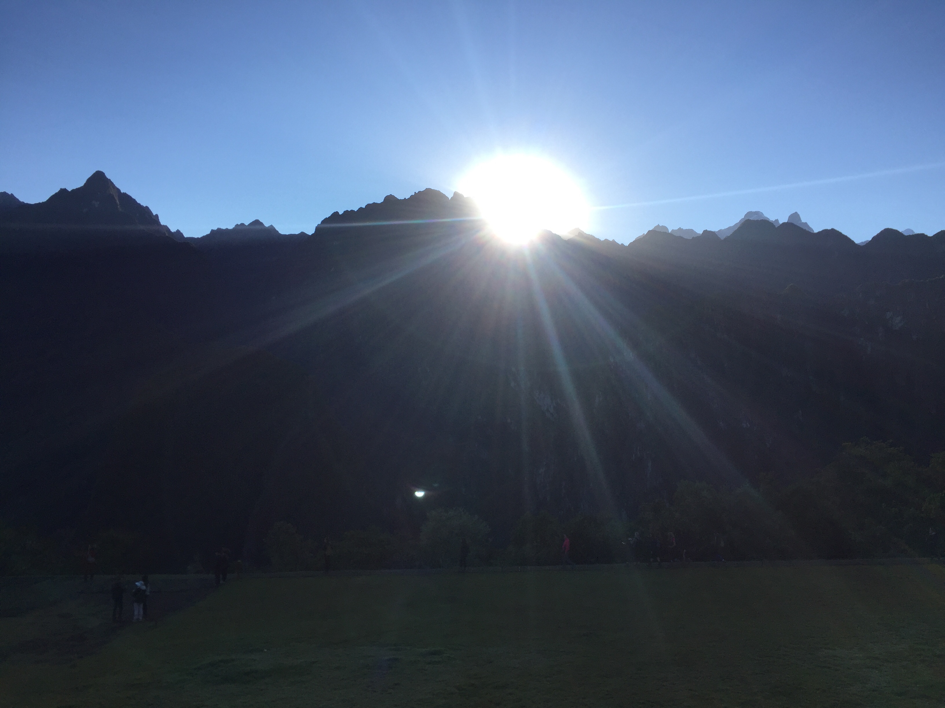
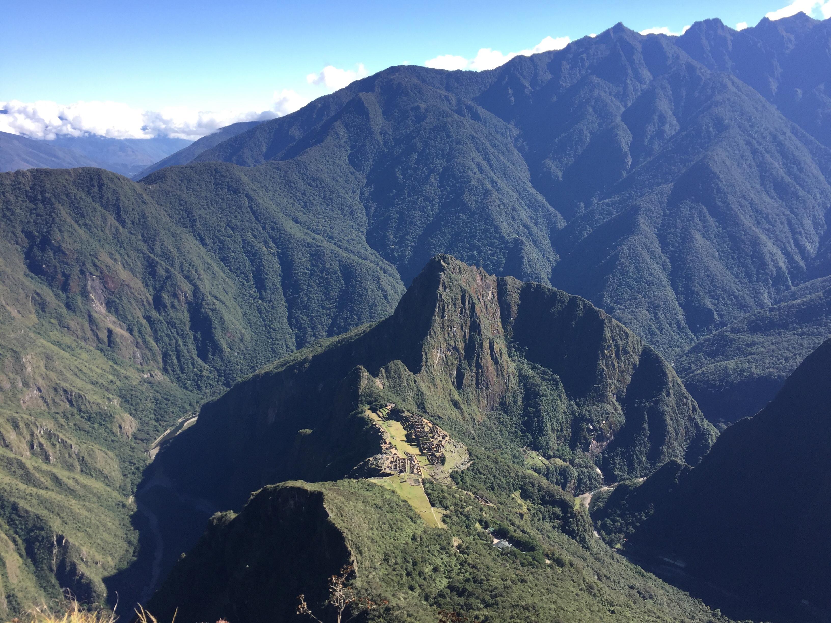
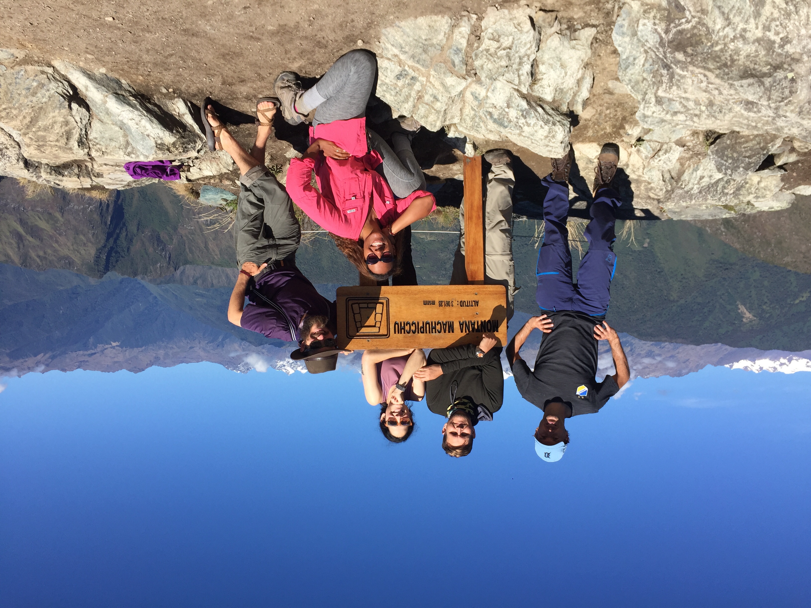
Yesterday was the last day of our trek which was also the highlight: the visit to Machu Picchu. We got up at four o’clock in the morning and had to hike first for twenty minutes to the first checkpoint. From there we had to climb two thousand steps to get to the entrance of Machu Picchu. There, some of us had paid for the entrance to Machu Picchu mountain which meant another two and a half thousand steps. The view from up there was marvellous though, so it was worth all the hard work.

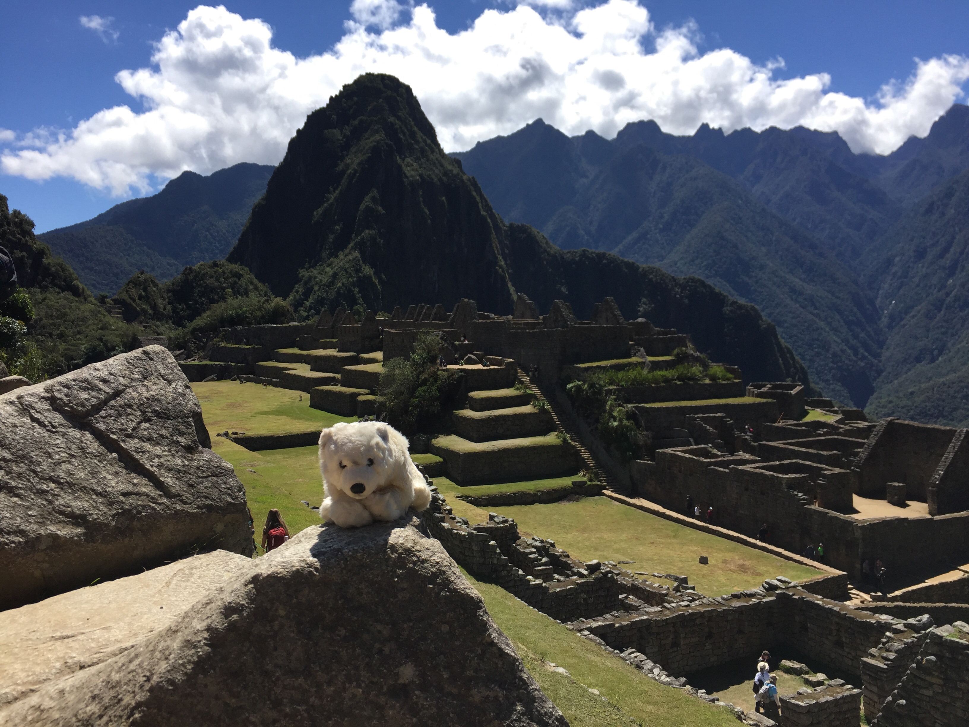
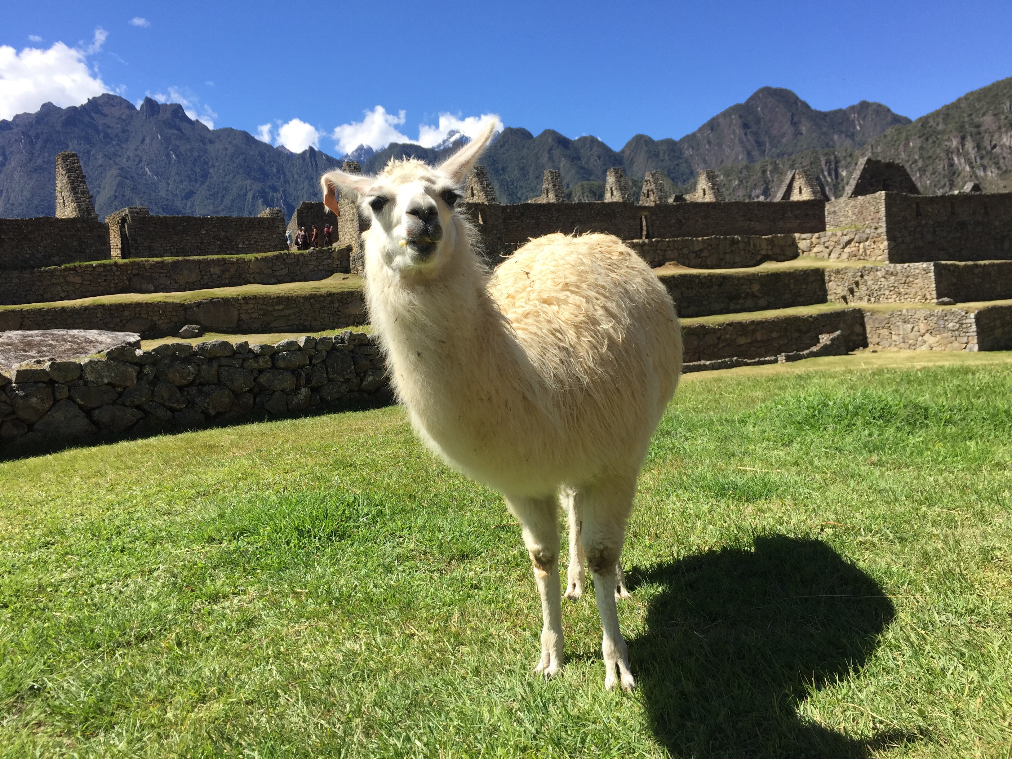
We had beautiful weather and after our return from the mountain time to walk through the remains of the old citadel. In the afternoon, we returned to Cusco by train and car. From here my trip continues to Arequipa, Lake Titicaca, La Paz in Bolivia, and finally back to Lima.

Through the rainforest

On our third day, we continued our hike through the rainforest to Santa Teresa. After a few hundred metres, we took a break and everybody got their faces painted with colour from a red berry.

The weather was fine in the morning after it had rained all night. But soon it started raining again, and it continued throughout almost the whole day. Fortunately, we had only half a day of hiking until lunch. But that was still six hours, so it was nice to get into warm clothes.

Our chef had prepared a very nice lunch with alpaca shaped nachos and guacamole. From our lunch place we had a rather adventurous bus ride through the jungle on a road which ran along the edge of a valley the whole time.

In the afternoon we visited some hot springs and could relax our muscles in wonderfully warm water.

On our fourth day, we will continue hiking towards Aguas Calientes. But first we will go zip lining in the morning.

From snow right into the jungle

Today, we were woken up at 4:45 with a Peruvian wakeup tea and left our camp at six o’clock. From the camp, we had a steady uphill trail for several hours. After a short time, it began to snow. And soon we were walking in several centimetres of snow. I would say that our group was fairly well prepared, but there were lots of other people on the trail in jogging shoes and jeans. Apparently, Peruvian trekking companies are not as strict as Icelandic ones who wouldn’t let people in such clothes hike into the highlands.

It was a beautiful landscape though and rather spectacular with so much snow, which was a first time even for our guide Susan who has guided this trek a hundred times.

We reached the Salkantay pass, our highest point of the trail at 4600 metres, at ten o’clock. And somehow I managed to overtake our team without noticing. I thought that most of them were still ahead of me, so I continued towards the spot where we were going to have lunch. After a while, I realised that they were probably behind me. But by that time, the weather was so bad that it was better to jus my continue to the lunch spot. The group arrived some time after me, and they hadn’t been waiting long, but realised that I had probably been ahead. So everything was good.

After lunch, we had three more hours to walk. And while it was still cold and rainy when we left after lunch, we soon got from the mountainous landscape into a rainforest. The rain stopped and the sun came out, and it seemed unbelievable that we had been in a snowstorm just a few hours before. I eventually took off layer after layer and walked into our camp in a t-shirt today.

Tomorrow will probably be a warm day and possibly one with moscitos. But at the end, there are supposed to be some hot springs we can sit in. So that seems like a very nice thing to look forward to.

Trekking in Peru

After the last cycling trip, Nansen and I are now on a trekking trip again. We are going to hike the Salkantay Trek to Machu Picchu – supposedly one of the most beautiful hiking trails in the world. It is less known than the Inca Trail, but also very popular.

On Thursday, we arrived in Lima and spent the first night there in a hotel. Then we continued the next day to Cusco, the old Inca capital. I wanted to spend a few days there before the trek in order to get acclimatised to the altitude. Cusco is located at 3400 metres above sea level. It is a very nice town with a long history. However, since all tours to Machu Picchu Start from there, there are also many tourists there.

Today, we started the trekking. In our group, there are eighteen people and one polar bear, plus our two guides, Susan and Jean Paul. Not sure if that is spelled correctly – they are both Quechua from this region.

On this first day, we left Cusco at 4:30 and started hiking from Challacancha around ten o’clock. After three hours, we reached our first camp, Soraypampa at 3900 metres. From here, we had a nice afternoon stroll to the beautiful Humantay Lake. This was also a good preparation for tomorrow because then we will cross our highest point, the Salkantay Pass at 4600 metres.

Wakeup call is at 4:45.

Arrival to Vancouver

On the wall in my bedroom, there is a photography of Vancouver. That is because I lived this city when I first visited it eight years ago. So I had a lot to look forward to when I left Whistler this morning.

My bike was decorated with a Canadian flag that I found lying in the ditch one of these days after Canada Day. I didn’t bring any flag on this trip, but when I saw this flag lying there, I thought that was a sign for me to bring it along.

The first thirty kilometres were mainly downhill, so I made good progress in the morning. My first intermediate goal for today was the town of Squamish where I had a quick lunch in the restaurant under the Golden Arches.

From there the route was following a sound, so I had the sea on my right hand side all the time. It was a very scenic route, but unfortunately a lot of traffic as well.

When I came to Horseshoe Bay after 100 kilometres, I had to decide whether I wanted to take the bus from here or continue for another 20-25 kilometres and cycle all the way downtown. During the morning, certain body parts were hurting so much that I thought there was no way I would even reach Horseshoe Bay. I was about to jump on a bus from Squamish already. But by the time I reached Horseshoe Bay, it was too tempting to cycle all the way downtown, along the coastline, over the bridge to the city centre and between the skyscrapers. So that’s what I did in the end.

I reached my hostel on Granville Street at six o’clock. After two weeks of cycling and lots of great experiences, I now have time to relax and enjoy the big city life in this awesome city. I might post some more pictures on Instagram, but for this blog, it’s over and out for this trip. Thank you for following! Until the next time.

Leaving from Whistler in good spirits – with the Maple Leaf on board

Scenic ride by the sea today

Yep – that’s downtown Vancouver in the background

Here we are downtown Vancouver after 125 km today

Granville Street

Vancouver skyline

Finding the Olympic spirit up to Whistler

So, the original plan was to be in Whistler early so that I could potentially take one of the cable cars up the mountain and enjoy the view. But the clouds were hanging so low today that there weren’t any views today at all.

I left my campsite at ten past eight and continued my ride along the Cayoosh Creek. The first three hours were only uphill (imagine I had done the last part of yesterday’s stage and the beginning of today’s at once). Then I finally reached the highest point and from there it was a long downhill ride – 1000 metres elevation on thirteen kilometres.

Down in The Valley it was dry and warm again. I stopped in Pemberton for a quick lunch (two slices of pizza) and checked the weather. The forecast said heavy rain in the afternoon, which seemed odd to me because in Pemberton it was quite nice.

Well, the meteorologists knew their business. The three hours from Pemberton to Whistler were tough because they were all uphill, and it was pouring down like crazy most of the time. Luckily, I had booked a hotel (specifically a pod hotel) for the night. So no matter how wet I was, I knew I would have a warm shower and dry clothes eventually. That was the spirit which brought me up to the location of the 2010 Olympic downhill ski events.

The centre of Whistler village is a pedestrian area, and it is very confusing. So it took me a while to find my hotel. I found a liquour store before I found the hotel, so I grabbed two Bud on the way as well (no local brew in the cooler). The hotel is pretty cool. The pod consists really of the bed only and a shelf. But it’s cheap, clean and stylish, and the staff is really friendly.

Also, for the bear record, there was a black bear in the pedestrian area tonight. It stayed there for a while and tried to hide from all the tourists with their cameras. But the police chased it away eventually with fireworks. It was very scared the poor thing.

Tomorrow is the big day – going to Vancouver finally. It will be 120 kilometres if I ride all the way to my hostel, or 100 kilometres if I skip the downtown traffic and get a bus from the harbour. We will see what my legs say (or rather my bottom) tomorrow.

Duffey Lake

Low hanging fruits – or clouds

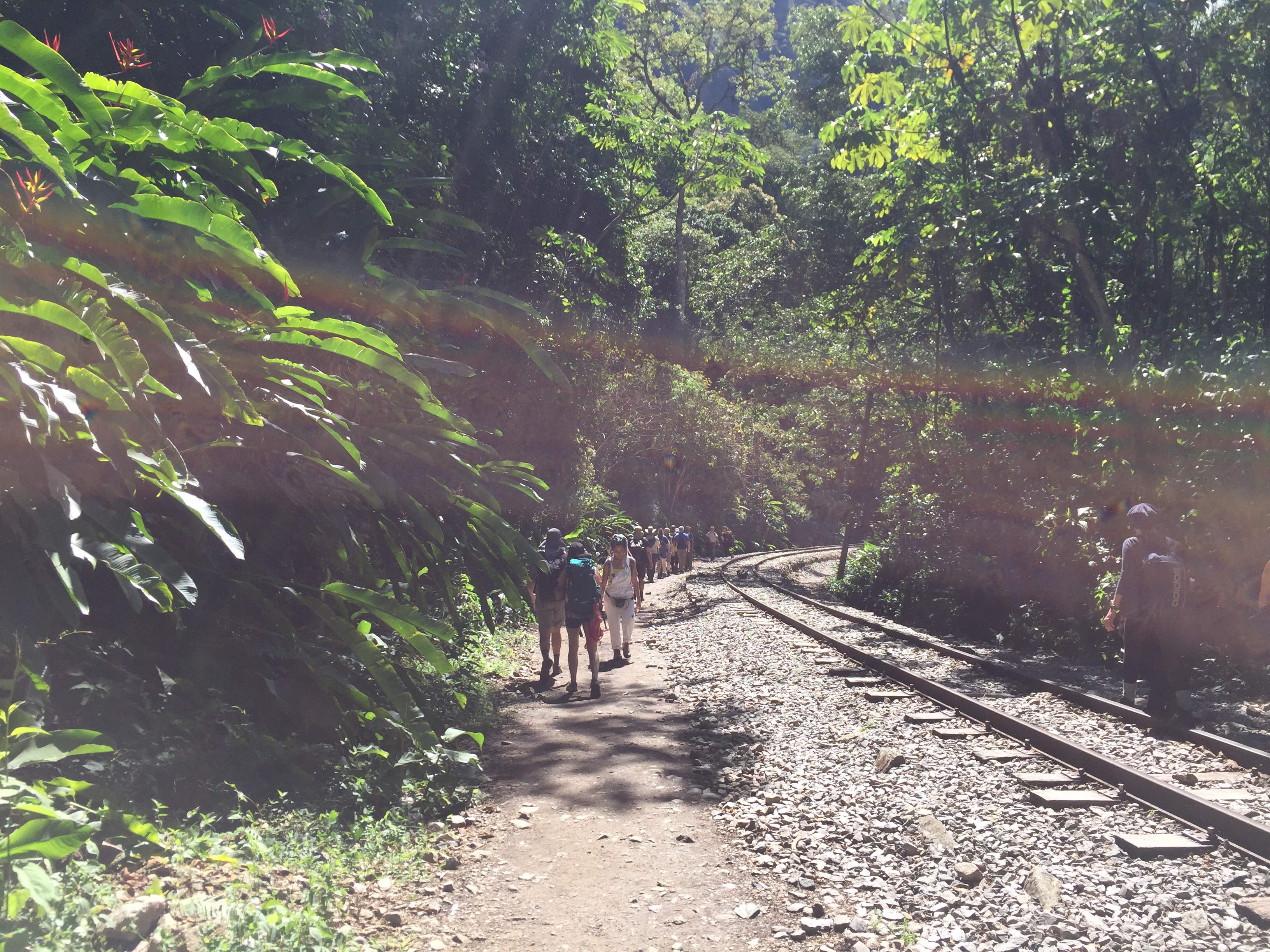
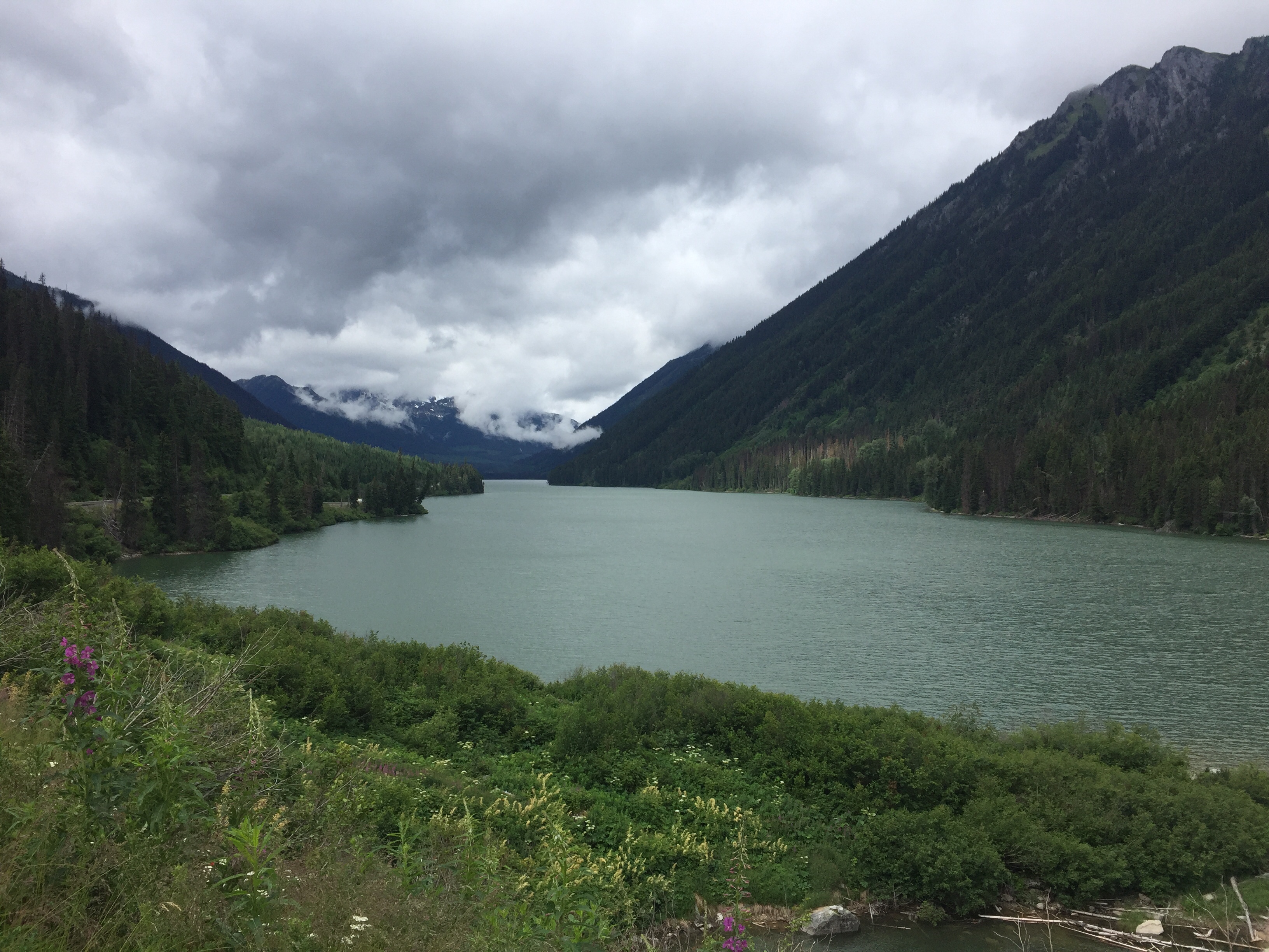
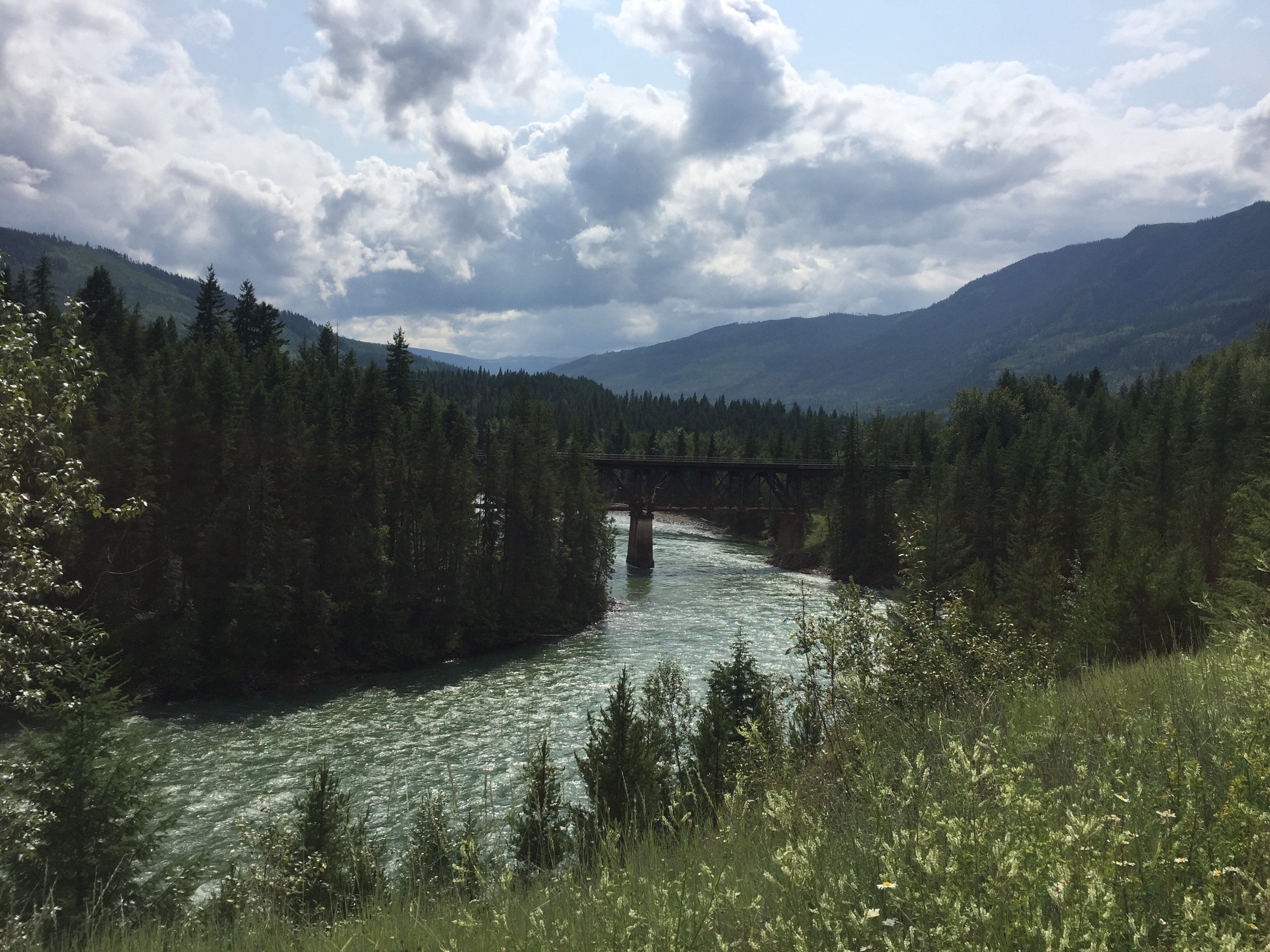
Dark clouds over Green Lake, Whistler
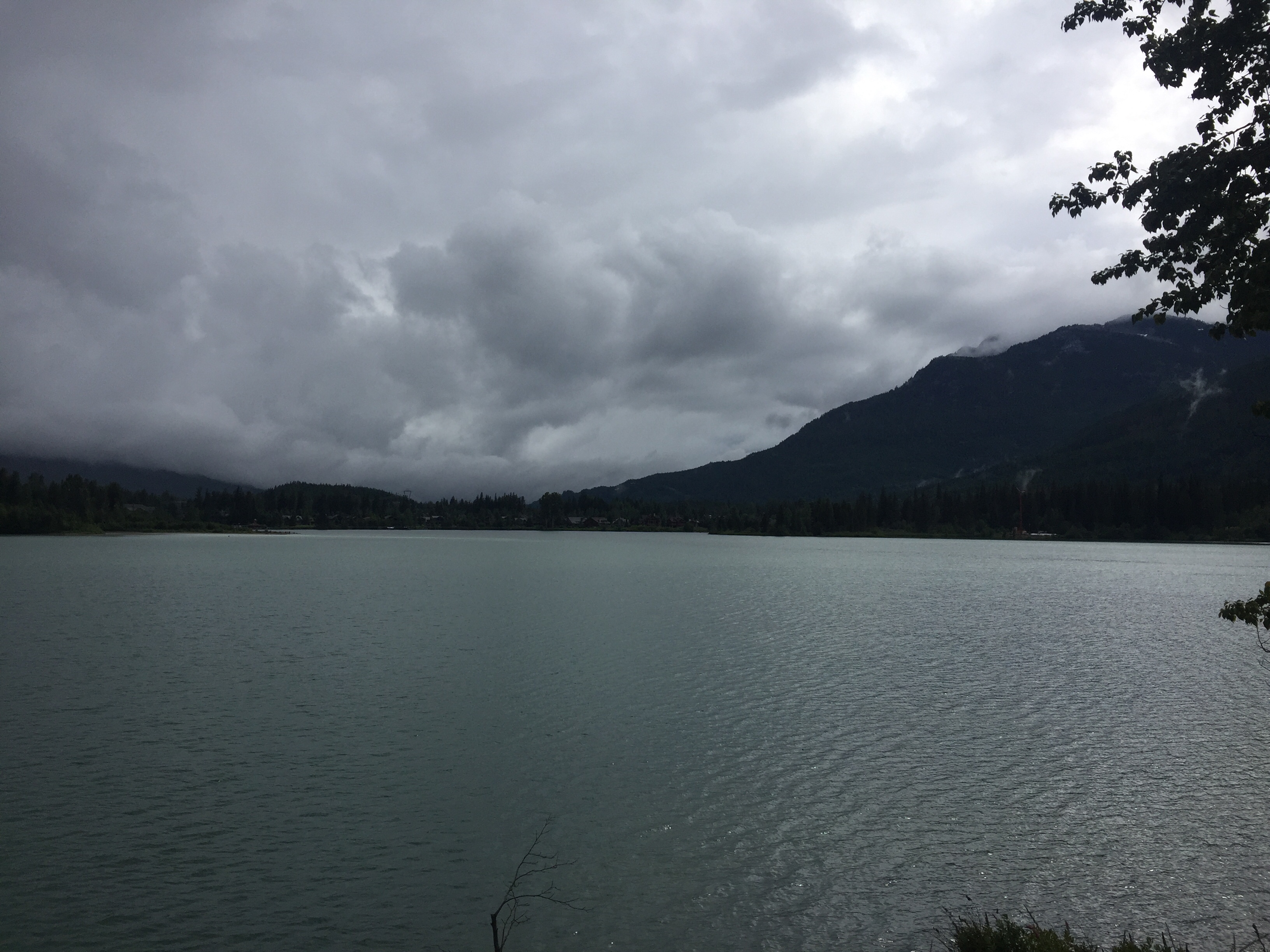
My cosy pod at the Pangea Pod Hotel

Bear in mind you’re in grizzly country!

Day 11: Hat Creek Ranch-Gott Creek

Today’s stage I had mentally split into two parts: The first one from Hat Creek Ranch to the town of Lillooet was about 75 kilometres. The second part would go into the mountains from Lillooet for another 23 or 31 kilometres, depending on which campsite I would stay at.

I thought that the first part would be relatively easy going because Lillooet is located at 260 metres above sea level only and thus lower than my starting point. What I didn’t know was that there was a lot of up and down on this part already. So instead of four hours as I had expected, I used five hours and arrived first at 2:30. I also felt a lack of energy today on this first part.

In Lillooet I had a quick lunch break at a petrol station and left for the second part, for which I had estimated another three hours, at three o’clock.

The climb from Lillooet was very steep. And it was extremely hot today – 39 degrees Celsius according to my tachometer, and the sun was burning like crazy. However, I felt more energised during this second part. So even though I took many breaks in between, I climbed kilometre after kilometre and reached eventually the high valley which follows the Cayoosh Creek all the way upstream. Here I reached at 5:30 the first possible campsite, but decided to continue because I still had some energy and I wanted the day to be shorter tomorrow. Shortly after six o’clock I finally reached the place to stay tonight. It’s called Gott Creek Recreation Site and is one of those unserviced campsites run by the state of British Columbia. It is a very idyllic place directly at the river. And there is only one other family with a caravan here. After a while a park ranger came to collect the camping fee which was almost nothing. I commented that there were no bear boxes to keep the food and asked whether I should still keep my food outside the tent. He confirmed and said that bears haven’t really been a problem there, but that I should bear in mind that I was in grizzly country now.

From here to Whistler it is now “only” 99 kilometres. I’m planning to leave early so that I can see a bit of Whistler when I arrive.

It was a dry and hot day – not much vegetation here

Fraser River down there in the valley

The last three hours were uphill – and it was hot!

Turn after turn after turn up to today’s campsite

Wild Wild West

You know, sometimes you need a carrot to get the rabbit going. For tonight I booked a “prospector’s shack” at the Historic Hat Creek Ranch, a historic site from the gold rush in the 19th century. Anyway, in order to get here, I kind of had to go a thirty kilometres’ detour. But the place looked cool and they had a bison burger on the menu. So that was my carrot for the day.

I was a bit slow this morning. So I left at 9:15. Then the road was first a gravel road and then one with very rough pavement. So the first twenty kilometres or so went really slowly. It rained a bit in the morning, but then it turned out to be the sunniest day so far.

After fifty kilometres, I took a lunch break at 70 miles house (the place is named after the gold rush trail which started in Lillooet which was 0 miles). There I met two other fellow cyclists from Germany who were basically on the exact same trip that I was. Except they used a bit more time.

I reached the town of Clinton today after eighty kilometres and thought that the remaining thirty to the Hat Creek Ranch might become tough because I was tired already. But luckily, they were all downhill. So I arrived here at 5:30, could take a shower and change, and then I had this bison burger which was really good. Also, this place is cool. They have, apart from some historic information, a lot of animals. Some happy pigs, some horses including a foal that liked my camera, and a lot of cute marmots.

Tomorrow I will go to Lillooet and from there another twenty to thirty kilometres up the mountains again. The last part is supposed to be very steep and a long climb. So I’m planning to leave early, so that I reach Lillooet by one or two o’clock, have time for a lunch break, and then have the rest of the afternoon for the tougher part. Vancouver is definitely coming closer.

Getting closer

Oh deer!

Day 9: Clearwater-Horse Lake

For the last couple of days, I considered an exit option because of my knees hurting and other vital body parts (especially the one you sit on) causing major problems. There is a bus from Kamloops to Vancouver, and Kamloops was only 120 kilometres away from last night’s accommodation in Clearwater. So I could be in Vancouver in two days if I wanted. If I chose to continue, then there would be a tough stage into the mountains today and after that another four more long and mountainous days ahead of me.

I had to decide after thirty kilometres today. There, in Little Fort, the highway 5 continues southwards to Kamloops while the highway 24 would lead me into the Cariboo mountains in the west. The first twenty kilometres were tough, but then I started feeling better. So I chose not to take the cheat option with the bus, but continue to cycle.

Right after Little Fort, the road started to ascend. It was a long two hours’ climb with almost 900 metres elevation to the McDonald summit at 1300 metres. During the ascent, it was sunny and warm. Earlier in the morning and pretty much for the rest of the day, it was raining.

Twenty kilometres ahead my destination, I stopped at a small store where I got a hot chocolate for free (I must have looked pitiful, wet as I was) and bought some supplies for tonight. I’m staying at the Cariboo Bonanza Resort, a campsite with some cabins at the Horse Lake, which is run by a Swiss family.

I met a couple of deer today

They are quite curious

After the rain comes sun

Day 8: Blue River-Clearwater

Last night in my cabin, I heard the rain drumming against the metal roof basically all night. I planned to leave a bit later in the morning to wait for the rain to stop. So it was the latest start for me so far on this trip at a quarter past ten.

I had a mixture of sunshine and many rain showers during my ride today. I stopped for lunch in Avola because they have a supposedly world famous burger. But that one was so and so.

The last thirty minutes to Clearwater were very wet. So I am glad I can stay in a motel tonight.

After a couple of days in rather flat terrain, I’ll return into the mountains tomorrow, the Cariboo Mountains specifically. It will be a long day.

For statistics friends: I saw another bear today. So the bear count is up to four on this trip. This one crossed the road 100 metres in front of me. But I was going uphill, so by the time I came there, the bear had disappeared into the bushes already.

The Thompson river