
An Alaskan adventure
In June 2014, I headed out to my third attempt to climb one of the Seven Summits. This time the destination was Denali (formerly known as Mount McKinley) in Alaska, the highest mountain in North America at 6190 metres. Denali is a mountain which is technically not very difficult to climb, but very demanding physically. Some people even claim it’s physically tougher than Mount Everest because the altitude difference between base camp and the summit is, with approximately 4000 metres, bigger than at Everest, and there is no porter support at Denali, so you have to carry all your equipment and supplies yourself.
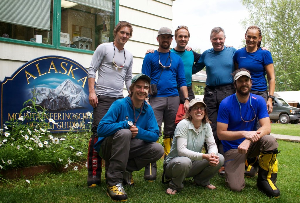
Our team: Marius, Chris, Stephan, Trevor, Vibeke. In the front our guides: Mike, Melis and Ryan.
Our expedition was guided by Alaska Mountaineering School (AMS) together with Mountain Professionals. Our guides were expedition leader Melis, Ryan whom most of the group including myself knew from previous trips, and Mike. The other participants were Marius from Norway, whom I knew from my Greenland expedition the year before, Vibeke, also from Norway, Chris from the US, and Trevor from England. On Saturday, one day after my arrival in Anchorage, I met Trevor for breakfast at the Glacier Brewhouse where we watched the football world cup match Germany against Ghana. After that, we took a shuttle taxi to Talkeetna, driven by a lady called Sarah who had a story to tell about every house, every road sign and every tree we passed on the way. At our motel in Talkeetna, I met Marius. And in the evening, we met Vibeke, Chris and Ryan at the Talkeetna Roadhouse.
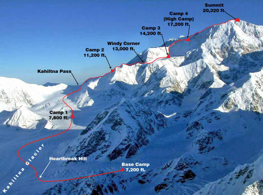
Our route was the West Buttress – the normal route on Denali
On Sunday we had a skills workshop together with AMS to prepare us for the trip. The workshop was really good and everybody seemed to be well prepared. That evening, we had a good last dinner and beer at the Brewhouse, and I had the chance to meet Talkeetna’s famous mayor, Stubbs the cat, at the grocery store.
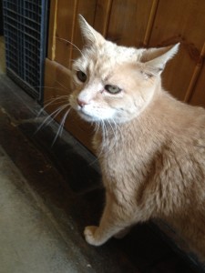
Mayor Stubbs
Day 1 to 5: From Kahiltna Base Camp to Ski Hill
Our expedition started on Monday, the 23rd of July! After an absolutely spectacular flight so close over the mountain tops that it almost felt like we could touch them from the plane, we landed at Kahiltna Base Camp and set up our tents for the first time. Kahiltna Base is located at 2200 metres above sea level on the Southeast Fork, a side arm of the majestic Kahiltna Glacier. The panorama in base camp was unbelievable. We got a glimpse of Denali on the one side, Mount Hunter looked spectacular on the other side, and on the third side we could see majestic Mount Foraker. With hardly any cloud in the sky, the view could not become any better. We planned to get up at two o’clock at night in order to travel out of base camp on hard snow before the sun became too strong. Marius, Trevor and I who shared a tent were lying stretched out on our sleeping bags already at eight o’clock. It was still sunny and warm outside, so I doubted that I would be able to sleep anytime soon.
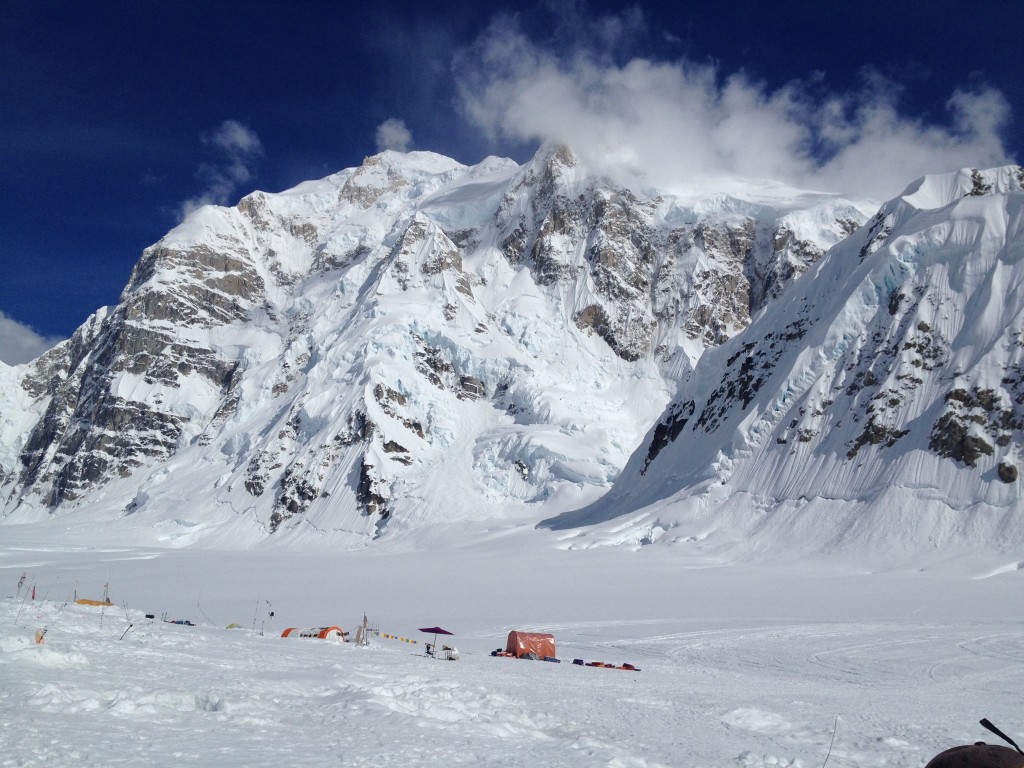
Kahiltna Base Camp
The next day we woke up a bit later than planned (around half past three) and left camp around five. The first part was downhill from the Southeast Fork to the Kahiltna Glacier. From there it was a quite gentle upwards slope to our second camp at the bottom of Ski Hill, 2450 metres (7500 feet) above sea level. Everyone was travelling with a heavy backpack and a sled. Since we were on a glacier with crevasses, we were travelling in rope teams of four. I had a bit too much weight in my backpack and hadn’t quite found out yet how to adjust the harness and the waist belt of the backpack, so the pack was both uncomfortable around my waist and my shoulders hurt. I knew, however, that it would be a rather short day, so I could live with it. I was happy though when we reached our second camp at the bottom of Ski Hill, which had a beautiful view up towards Denali and Windy corner. We took a nap after we had set up our tents and enjoyed a soup. Then we had a small introduction/review with Ryan how to use pickets and how to build a “dead man” with our ice axes – a kind of anchor in the snow. Dinner was pasta with cheese sauce and smoked salmon.
The following day we made a carry up Ski Hill. On an expedition like this, you often carry a part of your equipment up to a higher point, cache it there, descend again and sleep down at the last camp. The next day you move up with the rest of your equipment. That way you can divide the weight into two and you acclimatise better to the altitude. We started again at 5 AM and carried half of our gear to the top of Ski Hill at 3090 meters (10300 feet). Carrying half of our equipment felt much better than carrying all of it the day before. The pack was not too heavy, neither was the sled. We walked on crampons on our way up, but cached them there and walked down just in our boots. The weather was sunny in the morning, but we got quite a bit of snow, wind and whiteout during our way up and all the way down. Back in camp it was still snowing or ice raining when we enjoyed our dinner – which was fabulous: Melis made burritos filled with meat and cheese. I had three of them and was very stuffed – ready for a good night’s sleep.
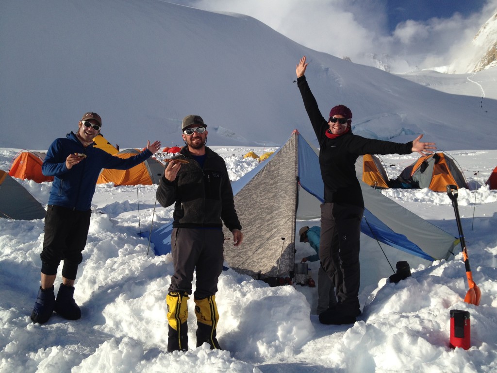
Happy camp life
Sometime during the night, Melis woke us up because our tent was completely buried in snow. When we got out of the tent the first time in the morning, there was around half a meter of snow outside. During the day, this amount almost doubled, so we had to do a lot of maintenance and shovelling to make sure that our tents would not be drowned in snow. There is not much to do on a day like this except waiting, relaxing and (most importantly) eating. Ryan made French toast with strawberries, maple syrup and ham for breakfast/brunch and tortellini with tomato pesto and cheese for dinner. Between meals and snow shovelling we were either lying in our tents or sitting in the kitchen tent chatting. At 8 PM we got the weather forecast and football world cup results via CB. Germany had won against the US, but both proceeded to the round of 16, so everybody was happy. The weather forecast predicted more snow and low pressure for the day after, but high pressure coming in for the weekend. Due to avalanche risk, we would most likely stay in camp the next day, too.
The night brought new snow – though not as much as the night before. I got up around nine o’clock to shovel a bit around the tent. Then we had a late breakfast and sat together in the kitchen tent for a while. It had finally become brighter outside and the snowing had almost stopped, so we were hoping to be able to move again the next day – using our snowshoes for the first time. In the afternoon, we had a short session with Melis who showed us how to use them.
Day 6 and 7: From Ski Hill to the 11000 feet camp
We had planned to leave camp at one o’clock in the morning, but when the snow had finally stopped, the wind set in so that we did not leave our camp as early as planned. Ryan informed us that we should be “on standby” and that we would not leave as long as the wind was so strong. A couple of hours later though the wind had stopped, so we left our camp at six. It was a beautiful morning with a blue sky and no wind at all. In addition, we were extremely lucky that another AMS team had left at twelve or one already and had broken a trail through the deep snow. So for us walking with our snowshoes was quite easy. When we reached 10300 feet where we had cached our gear we had some problems to find the right spot because we couldn’t find the right coordinates on our GPS at once. We found the cache eventually and took everything with us the remaining 900 feet up into the 11000 camp (actually at 11200 feet). Those last 900 feet altitude difference were extremely hard. The slope was steep, it was hot, the backpack was heavy, and so was the sled. I was really exhausted when we finally got into camp. In addition to that, I was worried that I might have hurt a rib and was hoping that would not become an issue during the next days. The camp was quite amazing though, and we had scheduled a rest day the day after.
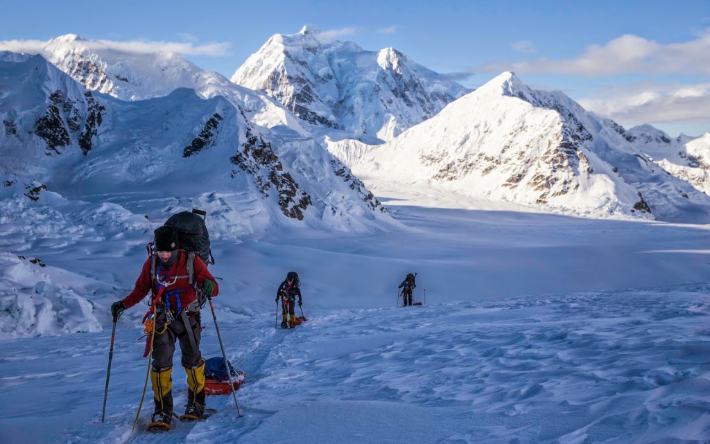
With heavy packs and heavy sleds on our way up Ski Hill
The rest day seemed to be a good idea because the weather next day was bad anyway. Some other teams tried to move up, but either had to cache and turn around or, as one team did, establish camp below Windy Corner due to strong winds. We had a very good night’s sleep and a late breakfast. In the afternoon we were supposed to do a little bit of climbing training (self-arrest etc.), but that was called off due to wind and snow. Instead, we built some walls around our tents because the weather forecast predicted strong winds further up the mountain, and we wanted to be prepared. For the next day, there was a chance of another weather day. If conditions allowed, we would make a first carry to a spot somewhere at Motorcycle Hill and cache some stuff there.
Day 8 to 12: From 11000 to 14000 feet
The next day started with some bad news: Ryan had to leave our group. He was struggling with a severe frostbite on his legs, which he got on his North Pole expedition some weeks earlier. He really wanted to go on this trip together with us despite that frostbite, but had to take the difficult decision now that he had to return because his condition got worse in the altitude and climate here. Therefore, we would have only two guides from here on, Melis and Mike, which was not a problem technically thanks to our small group size.
We were lucky with the weather though and could climb further after all. The night had brought a bit of snow, but not too much, and some other teams broke the trail early. Melis “played the old lady card”, as she said, meaning that we waited long enough so there was a nice trail broken by other teams. We left around 1:30 PM, wearing our crampons, and ascended first Motorcycle Hill, then Squirrel Hill, crossed the Polo Field and ascended the last hill (with no name) almost up to Windy Corner – a notorious spot which is often impossible to pass due to strong wind. There we cached some equipment at slightly above 4000 metres (13340 feet).
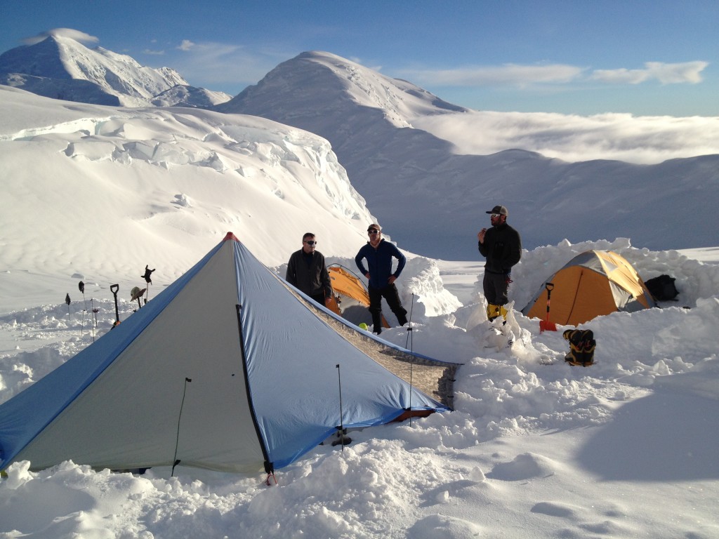
Enjoying dinner in the evening sun at Camp 2
The original plan for the next day was to relax and stay in camp the whole day and then leave at 8 or 9 PM to move up to the 14000 feet camp (4200 metres) in cooler temperatures after the day before was a bit warm. We had a late breakfast, and then it started to snow a bit. Melis talked to some guys further up the mountain and decided that we should rather move at once. With one person less in our team, our packs were even heavier than they would have been anyway. I guess mine was up to 30 kg heavy, which made the ascent very, very hard. We moved quite quickly though – again up Motorcycle Hill, Squirrel Hill, through the Polo Field, and up to Windy Corner. There we stopped and put on our helmet (the cached equipment stayed there), and continued with the final push to our new camp. It was quite windy and snowing in the beginning, but the weather got better after Windy Corner. I was struggling with my heavy pack. Everything hurt: my shoulders, my rib, my hipbone, the backside of my knees – so I didn’t have a good day at all. When we finally approached the last hill before our camp, I almost felt like reaching my first summit. I was very exhausted, at the same time happy to arrive soon, proud of the achievement and overwhelmed by the stunning scenario. We were almost at the same height as Mount Hunter now – that felt good.
The day after we slept quite long, had a late breakfast and then walked back to Windy corner to pick up our cache there. We had fabulous warm and sunny weather and a great view of Mount Hunter and Foraker. We were down at our cache in only half an hour. It took us a bit longer back up, but we still had some time to relax in our tents before dinner. After dinner, we reviewed our fixed rope skills as we were going to climb the Head wall up to a rock called Washburn’s Thumb the next day and cache our high mountain gear and food for week 3 there.
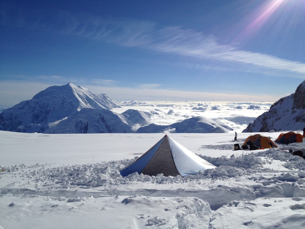
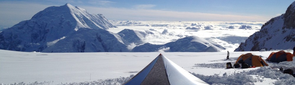
Our kitchen tent high above the clouds in Camp 3
We woke up at six o’clock after a night in which I had great problems to fall asleep. I only had three hours of sleep or so. At eight, we left to ascend the Headwall up to the 16000 feet ridge (4900 metres). When we started the weather was fine, but it got a bit snowy and windy after a while. The ascent was about as steep as Motorcycle Hill to begin with. Then we came to the part secured with fixed lines, which we had trained for, and everything worked great there as well. Up at the ridge, we were in the middle of the clouds, and visibility was poor. We cached our gear right below Washburn’s Thumb, probably at about 5100 metres. Fortunately, during our descent visibility became better. When the clouds broke up, we could see how exposed the ridge was. We had the most amazing view with our camp lying 600 meters below us, framed by Mount Hunter and Foraker, and the gigantic Kahiltna Glacier in the distance. Back in our camp, we could relax in our tents. We were all feeling well and had made good progress timewise, so summit between day 15 and 18 seemed in reach.
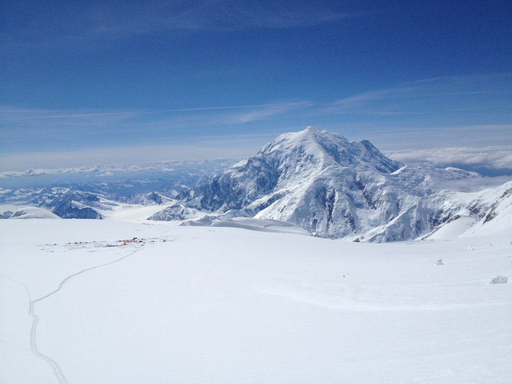
Camp 3 seen from above with Mount Foraker in the background
The next day was a scheduled rest day. We got up very late, around 11 o’clock, and had delicious pancakes with blueberries and maple syrup, which Melis served to celebrate the 4th of July. After breakfast, we went up to the lower third of the head wall in order to practice some climbing techniques and self-arrest. After a short soup lunch, we practiced to build a wall out of snow blocks which we cut out with a saw – that was nothing new for a Greenland veteran. We had been very lucky with the weather lately – it was another warm and sunny day. We could reach high camp within one day so that we would have a summit opportunity already two days ahead. I was already dreaming about coming back early to civilisation and seeing some more of Alaska, but first we had to climb this mountain! Everybody was still feeling great, so I was very optimistic that we would all reach the summit as a team.
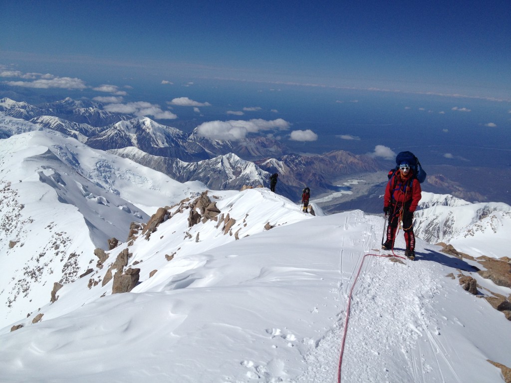
Marius on the 16000 feet ridge
Day 13: Move to High camp
In the morning, we ascended the fixed lines again and continued up to Washburn’s Thumb where we picked up our cache. The weather and the view were even more spectacular than the day before. I regretted a bit that I volunteered to take am extra gallon of fuel, which made my heavy pack even heavier, but I made it OK anyway into our last camp at 17000 feet (5200 metres). There we were lying in out tent as sardines – Marius, Chris, Trevor and myself. We only brought two tents up, but I had the impression that it would have been worth carrying a little more…
In the evening we planned the next day, which was supposed to be the big day if the weather was OK. We planned to leave between 9 and 10, and according to Melis it would take 10 to 12 hours. A German team had just made it to the summit, but they were still on their way down. They had used more than ten hours only on their way up. I really hoped we would be more efficient and, above all, that we would all make it and have a great day.

Mr. Nansen and I – ready for the summit
Day 14 (6th July 2014): Summit day
We started at 10 o’clock in the morning in quite good weather. The sun was shining, and there were only some thin clouds above the mountains. At this point we didn’t know that we would eventually end up in the middle of a snowstorm. We first ascended the rather steep “Autobahn” up towards Denali Pass at 5500 metres. Here we rounded a rock formation and then slowly but steadily gained height when we crossed a landscape in which the snow reminded me of sand dunes. At some point more and more clouds moved in, and it became clear that we wouldn’t get any picturesque photos from the summit. The last steeper section before the summit ridge was called Pig Hill. Here we had a slight delay, but finally we reached the summit ridge, which was a bit scary because it was very exposed and visibility was close to zero. Melis’ team with Trevor and Chris was the first to reach the summit after approximately eight hours. Our team led by Mike and followed by Vibs, myself, Mr. Nansen and Marius arrived directly after. The weather was so bad up there that we only took a small photo shoot and turned around almost instantly.

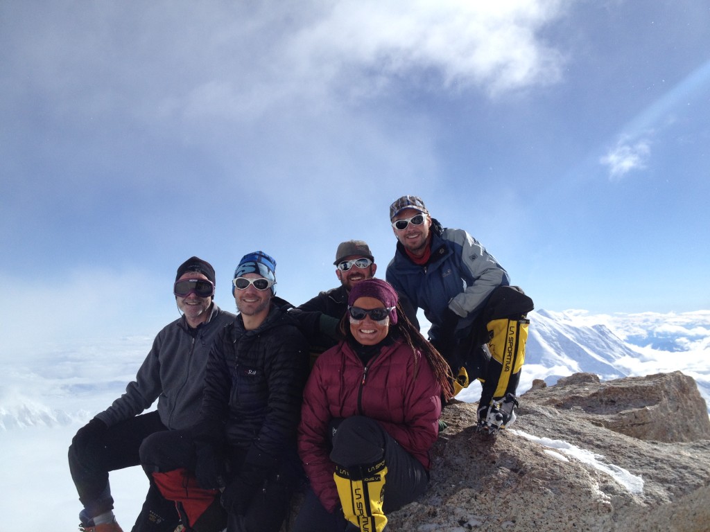
Summit success – from left to right: Marius, Stephan, Mr. Nansen, Vibs, Mike, Chris and Trevor. Not in the picture: Melis.
On our way down the weather got worse, and we ended up in a total whiteout. What made things worse was that both rope teams lost the track on Pig Hill so that we were completely disoriented. We moved up the hill again searching for the trail or one of the bamboo wands which we had used to mark the trail, but we didn’t have any success for a long time. At that point, I was sure we were going to spend the night in an igloo or a snow cave up there at almost 6000 meters. Fortunately, Melis finally found the track after a lengthy search, and Mike did a great job leading us back to our camp. All the way down we were in a complete whiteout, which made the descent mentally very stressful because you could not see your steps. In addition, this was one of the most challenging days physically which I had had in my life, so I was very happy when we finally got back into our cosy four-man-tent in high camp.
The storm got worse during the night, so we knew we would certainly not leave camp early. Sometime during the day, the storm lightened. Although we did not descend from high camp, we could at least get out of the tent and walk to a viewpoint called the Diving board to take some photos. The weather looked better in the evening, so we hoped that we could leave high camp the day after.
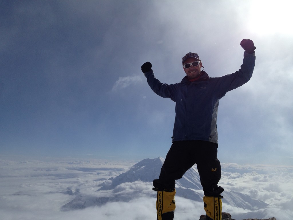
Photo shoot at the Diving Board – Mount Hunter looking small in the background
Day 16: “Walk of death” from high camp to base camp
The guidebook “Denali’s West Buttress” by Colby Coombs which everyone read before our trip, says about the descent: “While it is feasible to travel from High Camp to Kahiltna Base in one long push, breaking up the descent into two or three days is much more humane…” Unfortunately, we had missed some days due to bad weather both during the ascent and in High Camp, and we had uncertain weather conditions forecasted for the coming days. We needed stable weather, however, in order to be picked up by a plane from base camp, so we decided to go all the way from high camp to base camp – an endeavour which is referred to as the “walk of death.”
Our last day became a very long day. We started at high camp at 7:30 in the morning and arrived at base camp after midnight. Mike, Chris, Marius and I used seventeen hours in total. The other rope team arrived even one hour later. The first stage took us back to the 14000 feet camp, which we reached around 10:30. Some hours later, we took a longer break at the 11000 feet camp where we also retrieved our sleds. The hike down with the sled to the bottom of Ski Hill at 7800 feet went by quickly as I experienced. I found it also much easier to travel with the sled instead of carrying all of the heavy loads on my back. The glacier and the evening sky were beautiful at that time. At the bottom of ski hill we took a break and Melis could ask for the world cup semi final result – Germany’s had won against Brazil 7:1! We left from there at 20:30. The final part to base camp was supposed to take three hours, but it took us four. At that point we had been walking for more than thirteen hours, so I think I must have been on a kind of endorphin/dopamine rush because I just enjoyed the landscape and felt like I could continue to walk forever. The end of the trail was challenging again since we had to ascend the last section up to base camp – for that reason this slope is called Heartbreak Hill. We finally reached base camp and lay in our sleeping bags after 1 AM. Everybody just wanted to sleep, so we skipped dinner. The weather outside was bad, so a flight out the next morning was highly unlikely.
Melis woke us up the next day and asked us to get ready for departure after all – the weather was slightly better than expected. One hour later, we confirmed flying conditions over the radio, and our plane started from Talkeetna. The flight back was another adventure because we were flying over the glacier below the clouds, and our pilot struggled to find a way up through the clouds. He found an “exit” finally, and we arrived safely back in Talkeetna. Here we could celebrate being back in civilisation, and our summit success, of course. I had another four days in Anchorage, which I enjoyed very much. Originally, I had thought about travelling some more in Alaska, but hanging out with friends and enjoying good food and drinks in Anchorage was much more tempting this time. I decided that I needed to come back to Alaska to travel more another time.
A great team